FIT in Action
Our technology is used around the world!
-
Mitigating human-wildlife conflict

-
Understanding forest regeneration

-
Monitoring a landscape species

-
Using drones and AI

-
Restoring populations

-
Protecting the Amazon

-
Monitoring our environment

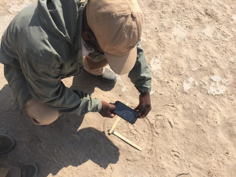
Lion and leopard conservation in Botswana
At Leopard Ecology & Conservation I and my colleagues Alessandro Araldi and Pogiso ‘Africa’ Ithuteng are seeking to promote the long-term survival of leopard and lion populations in Botswana by integrating conservation and community education. This requires an understanding of the status and habitat needs of large carnivores within the study area, in the Central Kalahari region. But the environment in which we work and the low density of animals that we find here, make many traditional scientific methodologies challenging. What we do have though is local San Bushmen trackers on the team, whose knowledge about this environment, and the animals that inhabit it, is unrivalled.
A significant proportion of our data collection relies on these skilled trackers finding, following and interpreting animal behaviour from the spoor of our study leopards and lions. By collaborating with WildTrack we are hoping to take this data collection to a whole new level, by empowering the trackers to more confidently identify which individual animal the tracks belong to. In this way our spoor data will become individual-specific, improving our ability to develop an in-depth understanding about what is happening within these carnivore populations.
For the past couple of months, we have been trialling data collection using the Epicollect app, starting to build a database of track samples from our study area. There were initial worries from both us and the WildTrack team that the sand in the Kalahari was going to be too deep and soft to produce decent tracks, and certainly some of our early photo collection suggested this might be the case. With very few roads in the study area we are often tracking the animals through thick bush, also making finding photographable tracks a challenge. But with time and patience we have found areas where there is suitable substrate, around pans and on the edges of roads, where the sand is less deep and good quality tracks can be found. In a few months’ time when the rainy season hopefully returns, we will likely find more opportunities to collect images as the sand is hardened and smoothed by the rain.
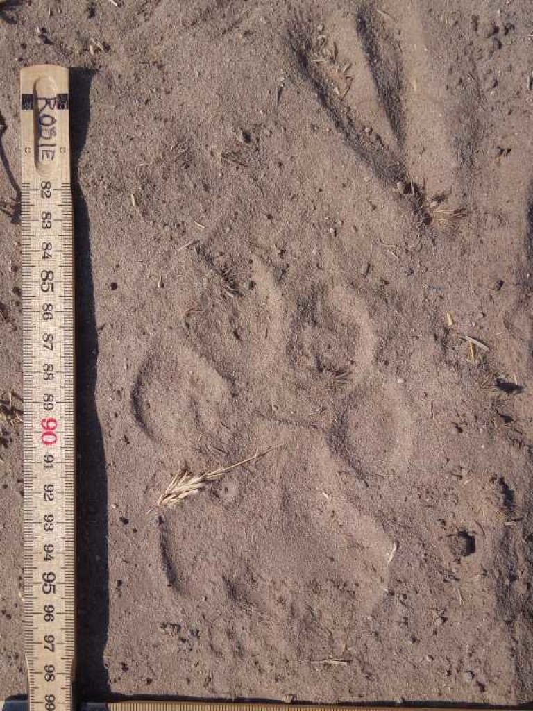
A couple of interesting things we have discovered already from our sample collection is that our cats often register, that is when the back foot lands on top of where the front foot was. This makes it hard for us to collect many front footprints because they are partially obscured by the back footprint overlaying them. Also, the indentation of the track is always deeper and more defined at the rear of the track than at the toes, which is the opposite to what is more commonly seen elsewhere. This may be a result of the very soft substrate within which we are working.
So far, we have found the data collection both straightforward and enjoyable, and we can anticipate clearly what the tangible benefits will be for us to use the technology as it develops. The WildTrack team has been incredibly helpful and supportive, giving regular and constructive feedback, and we really look forward to continuing working on this project together.
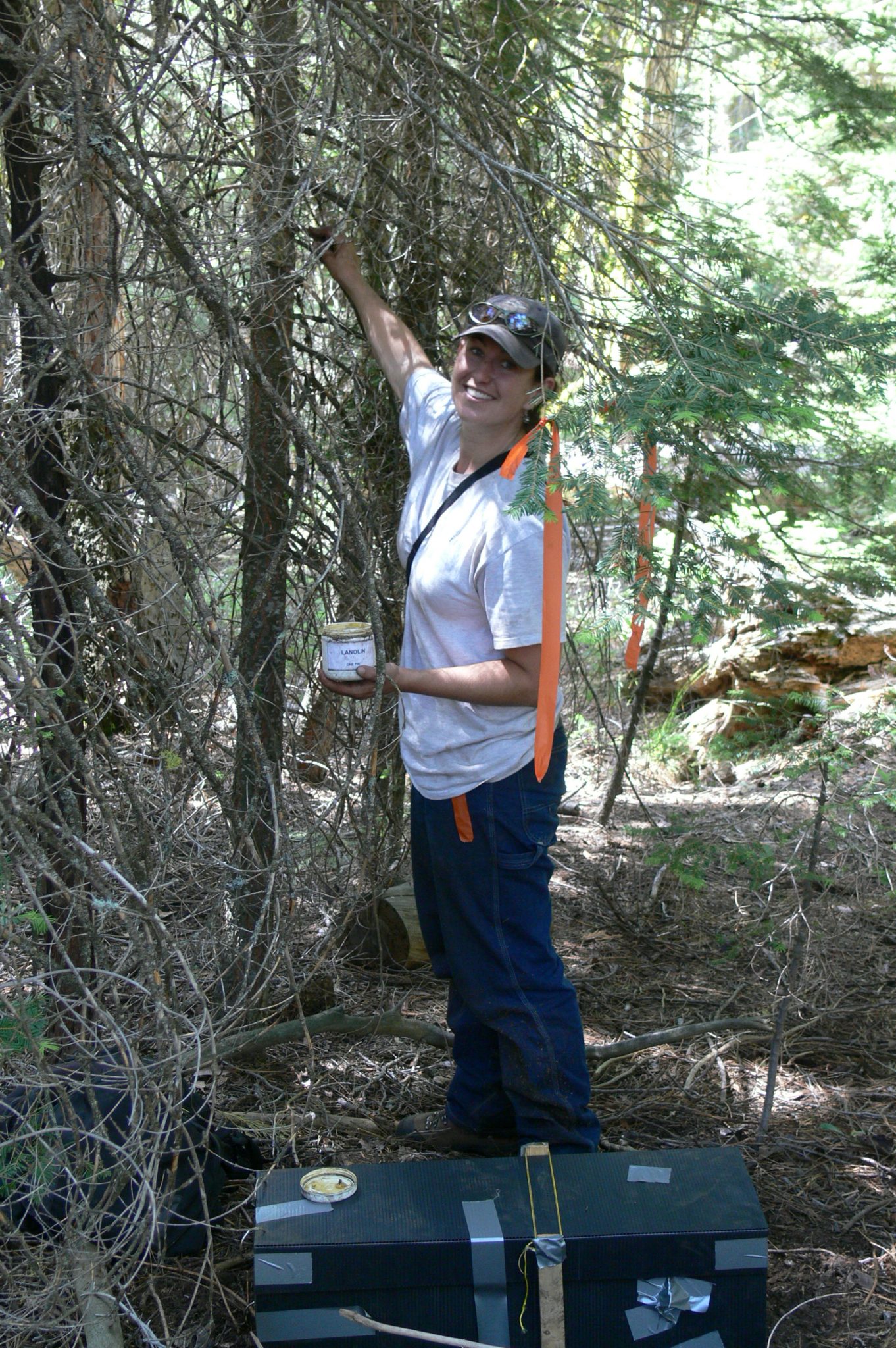
Smearing lure on a tree
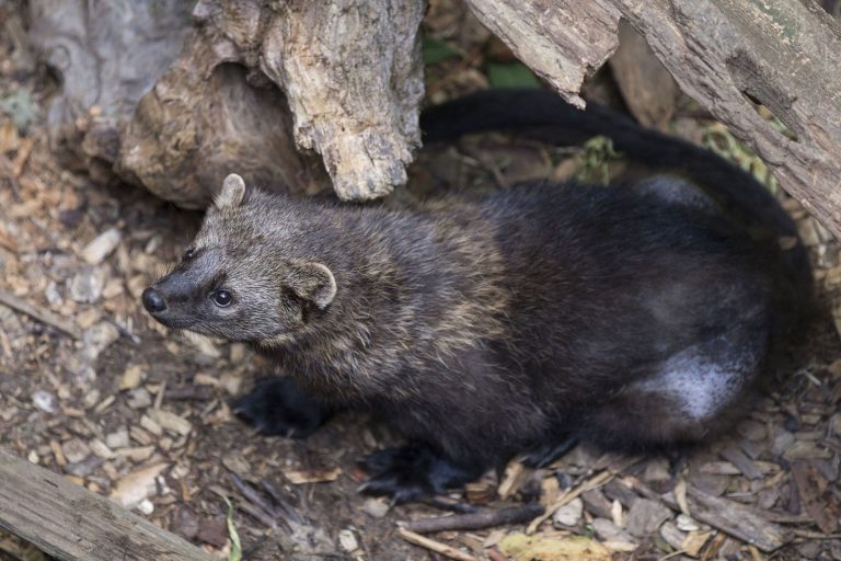
The Fisher
Fisher tracks on paper
Fisher and Marten in California
WildTrack has been partnering with Dr Jody Tucker of the U.S. Forest Service’s Sierra Nevada Carnivore monitoring program. Jody studies fisher (Pekania pennanti), Pacific marten (Martes caurina), and other associated carnivore species to assess population changes over time in occupancy, geographic distribution, genetic diversity and connectivity. Both species are considered species of conservation concern by federal and state agencies and fisher has been proposed for federal listing under the Endangered Species Act. Conservation concerns are particularly acute for the southern Sierra Nevada fisher population’s due to its small population size (<500 individuals), geographic isolation, low genetic diversity, habitat at high risk of wildfire, and recent widespread change in forest conditions due to drought and tree mortality.
Large scale monitoring of such rare and elusive species is very difficult. Trying to reliably detect a handful of fisher or marten across hundreds of thousands of acres in steep mountainous terrain is physically demanding, time-consuming and logistically complicated. Such landscape scale monitoring using capture based methods is cost prohibitive, so we rely on a variety of non-invasive techniques to study these populations: remote sensor camera traps, track plates, and hair snares.
While the use of cameras and hair snares are now ubiquitous in wildlife research, the use of track plates has become less common in recent years. Track plates are involved the use of a plate covered with a substance used as ‘ink’ to collect animal tracks (i.e. chalk, soot, printer ink) usually baited to draw an animal across the track plate surface. For our study we use a layer of carbon soot applied with a torch to a metal plate. Between the soot and the bait is a piece of white contact paper to collect tracks – this baited plate placed into a box enclosure.
Traditionally, tracks have solely been used for species detection with individual or sex determination only possible through genetic analysis at stations where a high quality hair sample is obtained. Recently, we have been collaborating with Wild Track to determine if FIT technology can be applied to track plate data to identify individuals. This technology would greatly increase the capacity to identify individuals and provide expand analytical options for monitoring these species. Additionally, as track sheets have been systematically archived for decades for fisher and marten in California, FIT technology could also potentially provide individual identification for this historical track collection.
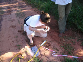
Pati Medici collecting tapir footprints in the Atlantic Forests of Brazil.
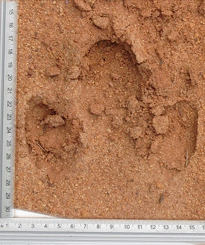
Lowland tapir footprint (Left hind)
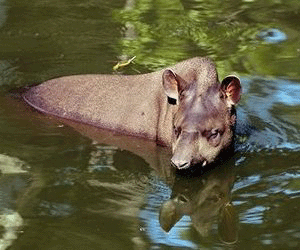
The lowland tapir in Brazil, and Baird’s tapir in Central and South America
Destruction of the native neotropical forest of the lowland tapir has caused it to be classified as Endangered on CITES appendix II. Baird’s tapir, also a South American species, is classified as Endangered on the IUCN Red List 2002.
We have been working for several years with Patricia Medici, Chair of the IUCN/SSC Tapir Specialist Group, to adapt FIT for monitoring the lowland tapir in Brazil. Pati has designed and coordinated an unrivalled collection of footprints from captive tapir all over Central and South America, and we have extracted a robust FIT algorithm for this species. Pati is now continuing the development of footprint monitoring from her base in the Brazilian Pantanal.
We have also worked with lowland tapir in Argentina, in association with Silvia Chalukian, director of the lowland tapir conservation and research project in Salta, and with Baird’s tapir in association with Jeremy Radachowsky of the University of Florida. The FIT algorithm has proven able to differentiate the two species where they are sympatric (some parts of Colombia and Ecuador).
Most recently we have partnered with Dr Dani Moreira to use FIT for monitoring lowland tapir in Brazil:
Moreira, D. O., Alibhai, S. K., Jewell, Z. C., da Cunha, C. J., Seibert, J. B., & Gatti, A. (2018). Determining the numbers of a landscape architect species (Tapirus terrestris), using footprints. PeerJ, 6, e4591.
Patricia Medici comments on the use of FIT for tapir monitoring:
“The development of the Footprint Identification Technique for lowland tapirs has been a fantastic step forward in terms of tapir research and monitoring. I initially used FIT to estimate lowland tapir density in the Atlantic Forests of Morro do Diabo State Park, São Paulo, Brazil, alongside two other methods, radio-telemetry monitoring and line-transects, yielding results that we could compare. FIT resulted in tapir population densities very similar to the ones obtained through radio-telemetry. I am now expanding my tapir research and conservation efforts to the Pantanal biome and will continue to use FIT to estimate tapir populations in this region. In my view, the main benefits of FIT are the fact that it is non-invasive, cost-effective and appropriate for elusive species difficult to monitor in other ways such as tapirs. Additionally, FIT has benefits over other non-invasive techniques in that the sex and age-class of the animal can be ascertained as well as the ID. Last but not least, footprints can also be classified at the species level. For example, in some areas in Colombia where Baird’s and lowland tapir are sympatric we can use FIT to differentiate between them. FIT is a wonderful research tool and I have no doubt whatsoever that this could be the future for wildlife research”.
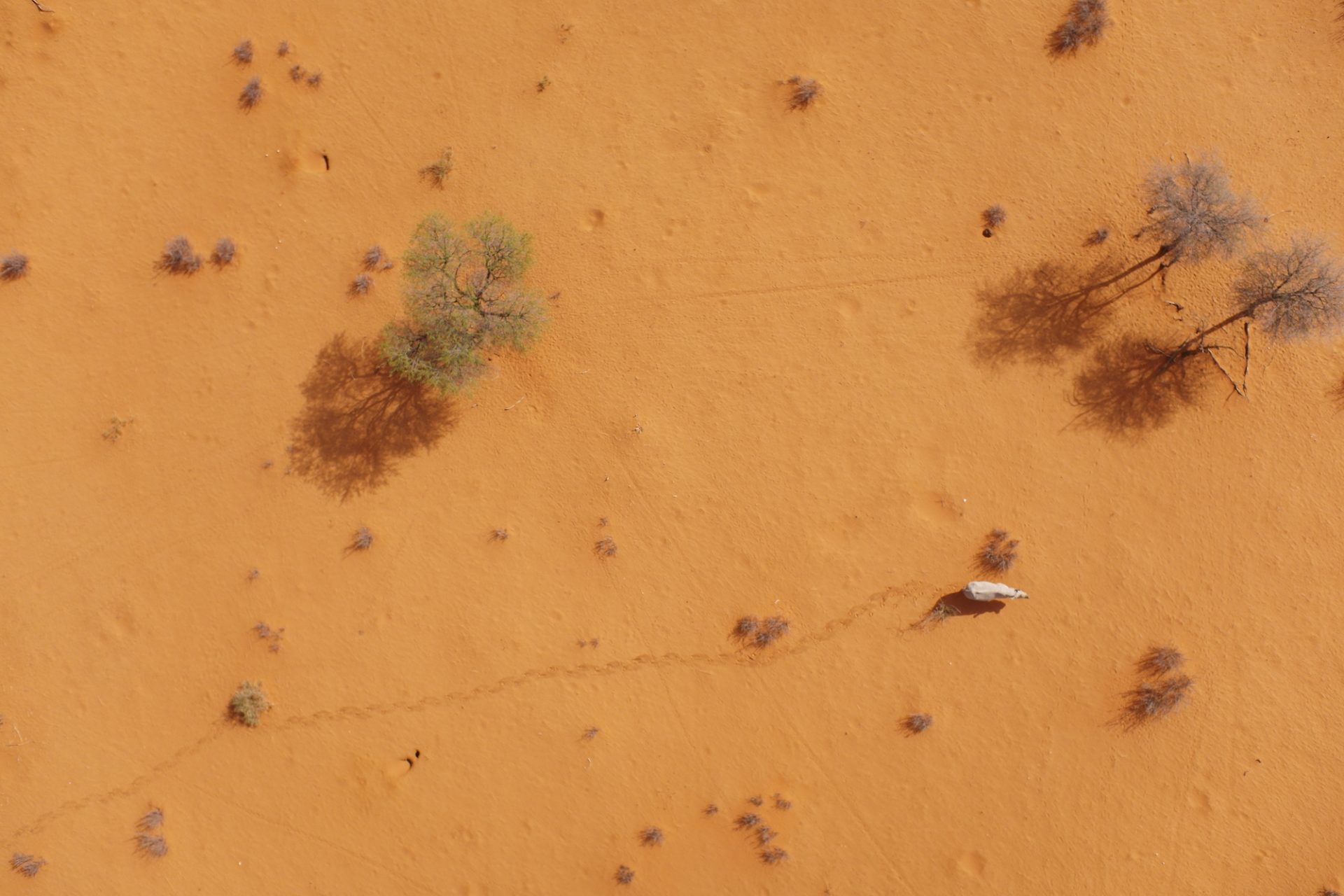
A black rhino in Namibia leaves a clear trail behind him as he ambles from bush to bush
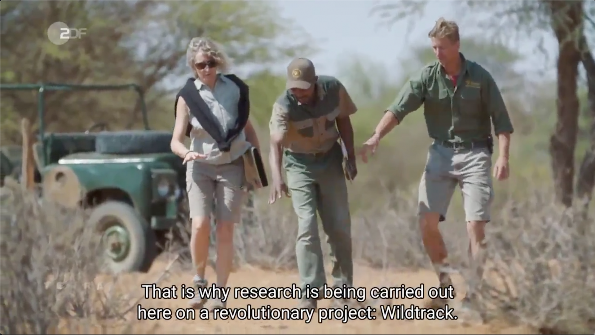
The WildTrack team in Namibia, including expert indigenous tracker, following rhino trails that have been identified by a drone
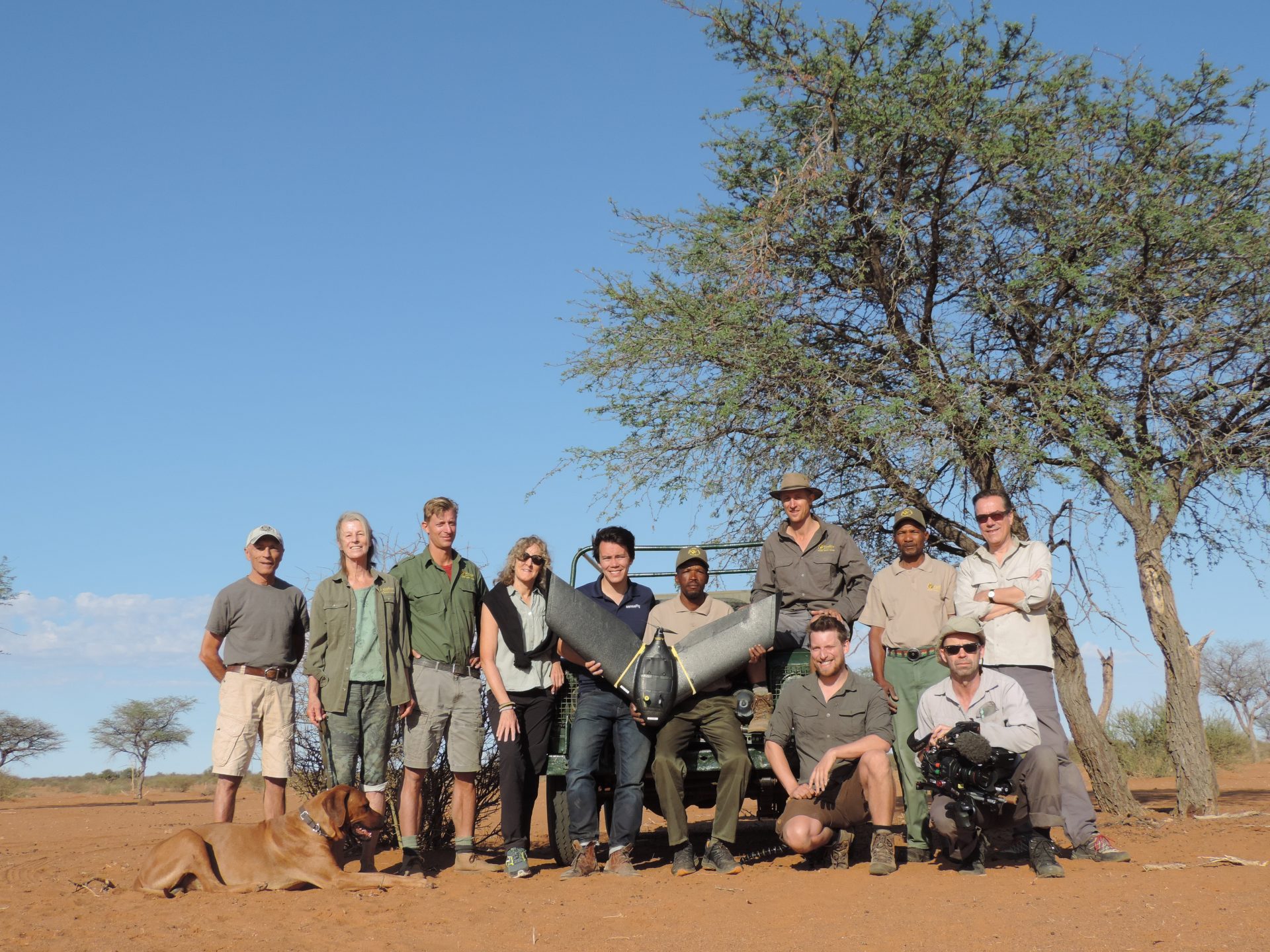
The WildTrack team with senseFly eBeeX in Namibia
Providing landscape scale monitoring of endangered species through the trails and footprints they leave behind
WildTrack has a unique and award-winning conservation model based on totally non-invasive methods and community-friendly approaches. Our award-winning technology is an innovative mix of millennia-old traditional ecological knowledge, and leading-edge analytics.
One way we can keep track of animals to protect them is through their footprints. Elusive and endangered species are often very hard to spot, but they leave trails of footprints behind.
UAVs are the perfect tool to find these trails - the birds-eye view can see landscape features easily, the UAVs then collect trail data, and we analyse them to identify species, individual, sex, and age-class.
With our amazing drone partners senseFly (eBeeX landscape drone) and Skydio (Skydio 2 multicopter drone) we are able to undertake:
The below TerraX documentary showcases our work in Namibia with the senseFly eBeeX aircraft.
Moving Forward
We're working to develop AI capability that will enable us to identify species trails on-the-fly and follow them. This is part of an end-to-end pipeline capability where footprint data will be seamlessly collected, analyzed and rapid results output for wildlife managers.
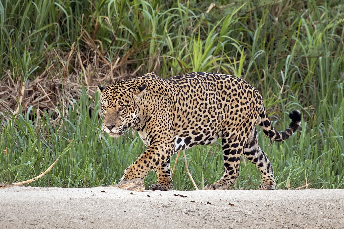
A male jaguar
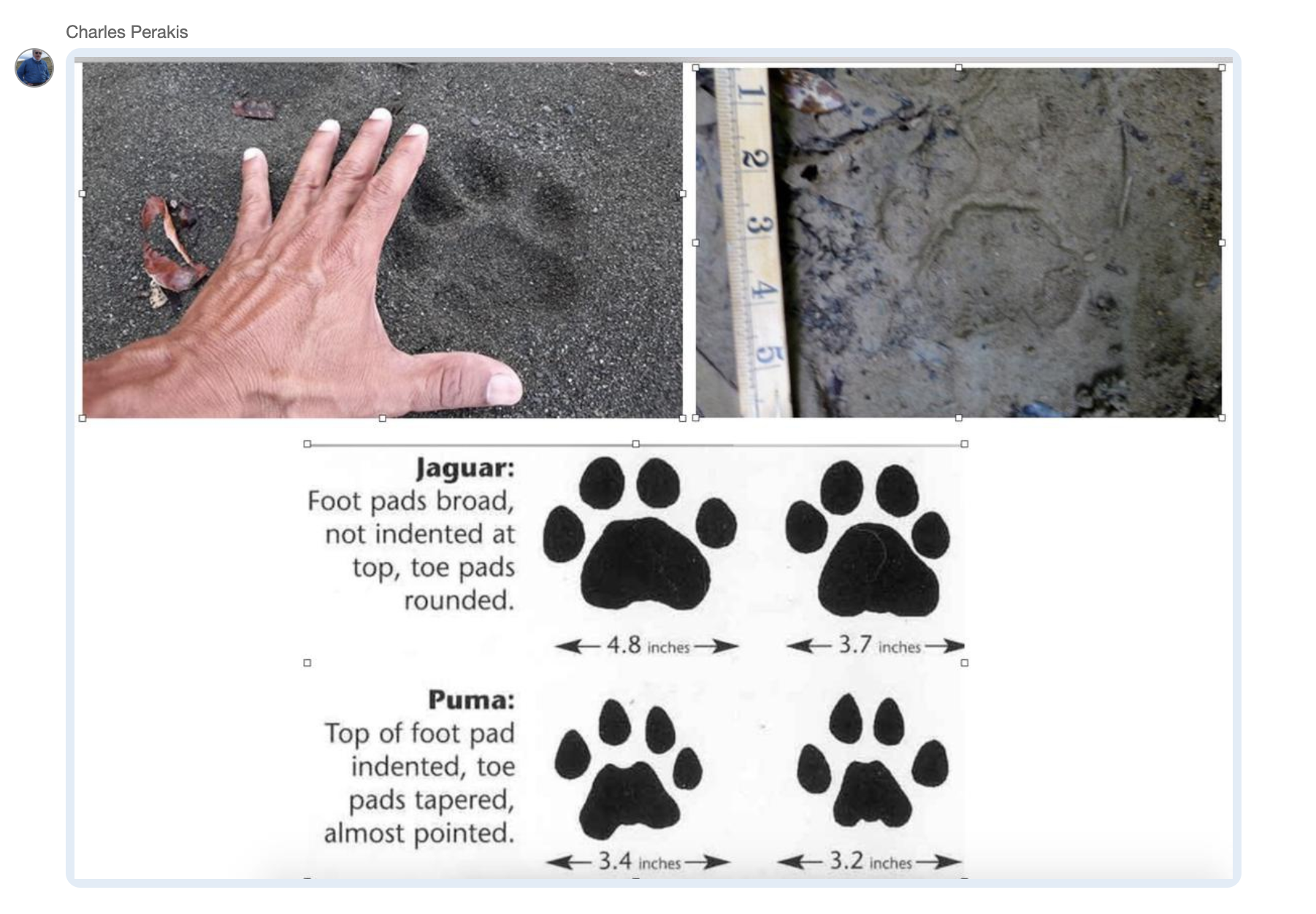
Jaguar and puma footprints differences
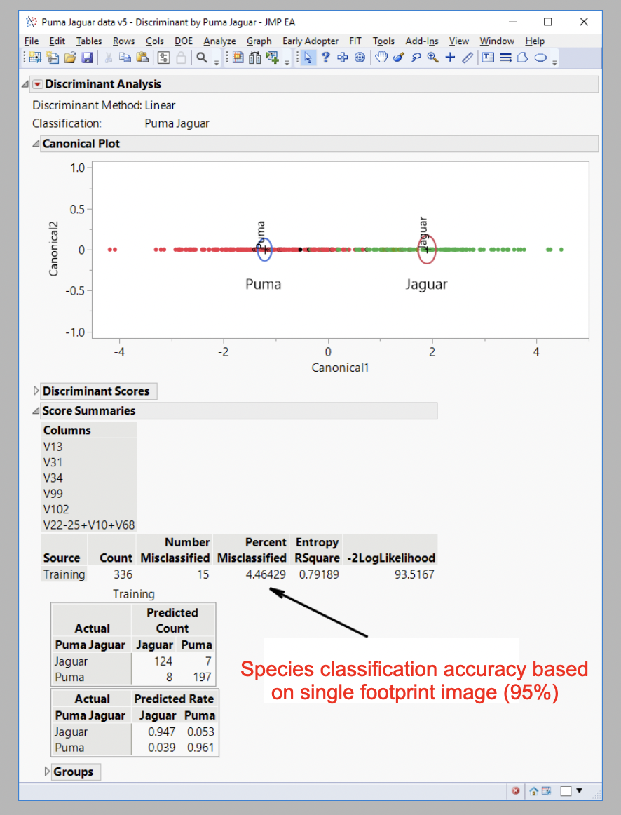
Jaguar and puma footprints identification
Jaguar and mountain lion in the Americas - understanding ranges, restoring populations.
The beautiful mountain lion (puma) and the jaguar, are two of the last big cats in the Americas. Both are under threat from illegal killing, road kill, and habitat destruction/fragmentation - and are now gone from the majority of their original ranges. These elusive animals are hard to see, and even harder to monitor, making it difficult to know where they most need our help.
Our project, in collaboration with the UFPA-Federal University of Pará, Brazil, allows scientists to identify the areas where they can be protected. WildTrack’s award-winning Footprint Identification Technology (FIT), uses community-gathered data, and incorporates rich local traditions of traditional ecological knowledge, morphometrics and artificial intelligence to identify them from images of their footprints, captured on the WildTrackAI app, without disturbing them.
We are currently building a strong group of partners in South America to develop a specific jaguar:puma discrimination test for field use where these two species are sympatric. Together we will collect images of footprints from known jaguar and puma to help us build our reference library for these two species.
The ultimate objective is to identify areas to protect wildlife corridors to encourage population recovery and stabilization in the face of ongoing habitat destruction.
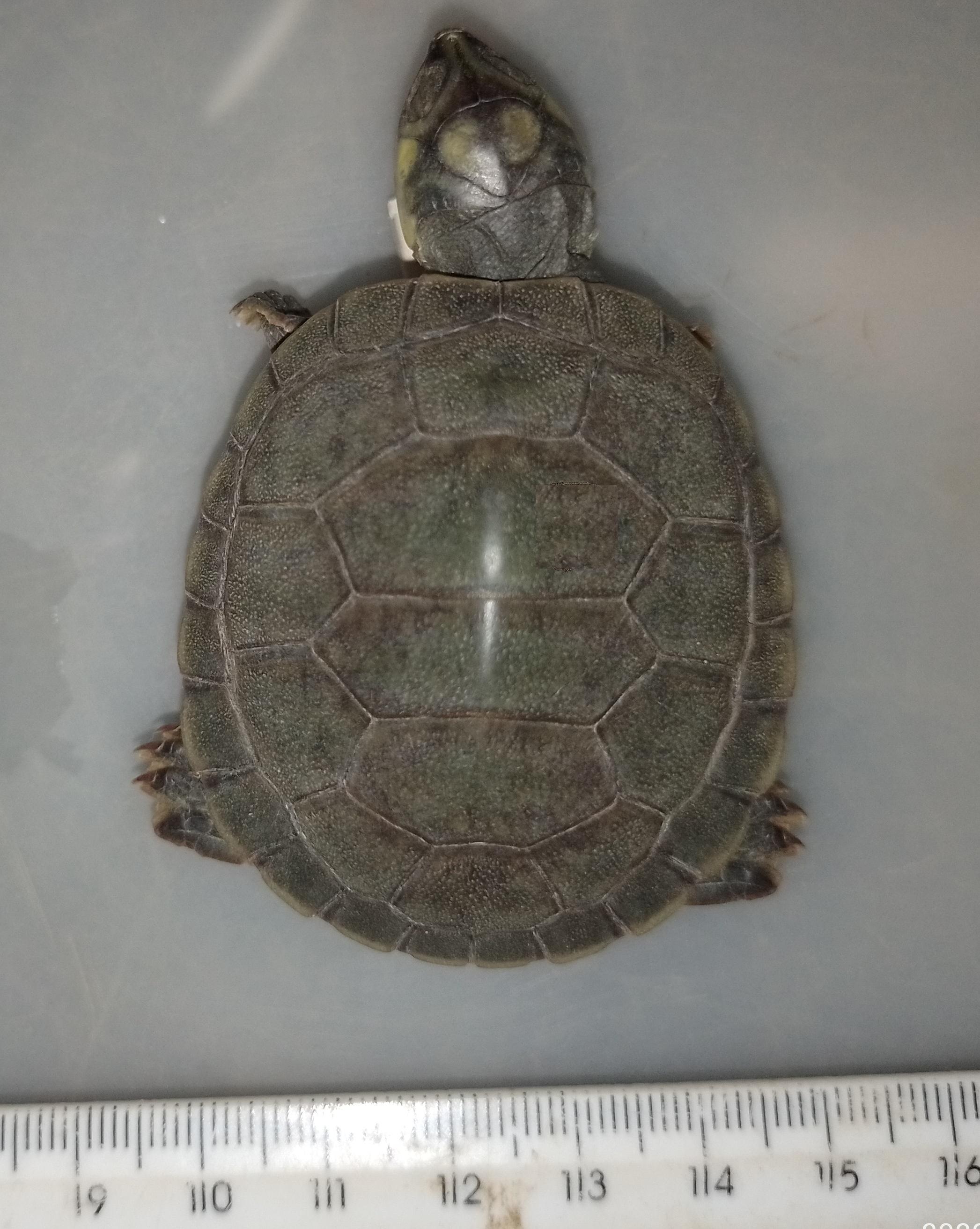
A hatchling turtle
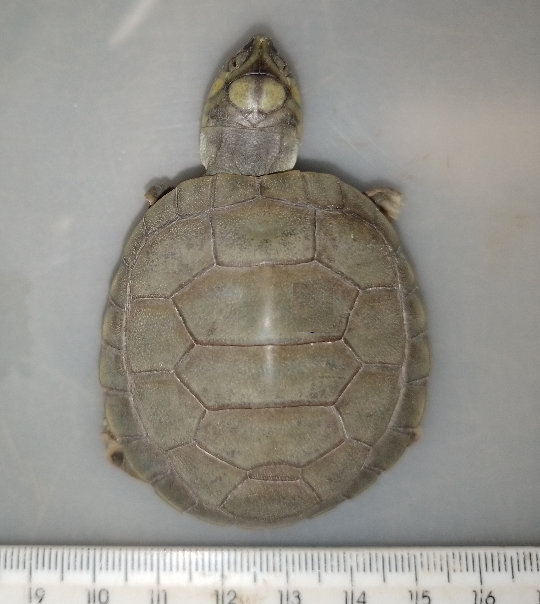
A hatchling turtle
Protecting endangered freshwater turtle populations in the Amazon basin, Brazil.
Freshwater turtles are a major part of the Amazon ecosystem, as decomposers of nutrients and dispersers of seeds. They are amongst the most threatened vertebrate groups, with more than 50% of species under threat. They are currently under threat from overconsumption of their meat and eggs by humans, medicinal purposes and for the pet market.
This project, in collaboration with Duke University, USA and the UFPA-Federal University of Pará, Brazil, is to use morphometrics and AI to identify the sex of freshwater turtle hatchlings to allow scientists to repopulate areas with breeding females that have been over-hunted.
Currently, the sex of hatchlings can only be determined by killing and dissecting them. WildTrack’s award-winning Footprint Identification Technology (FIT) using community-gathered data, and incorporating traditional ecological knowledge, morphometrics and artificial intelligence has delivered accurate sex-ID with other turtle species using a single image of the shell pattern.
This project will be used in the same way to protect the turtles of the Amazon river basin, and be used to identify the sex of each animal non-invasively.
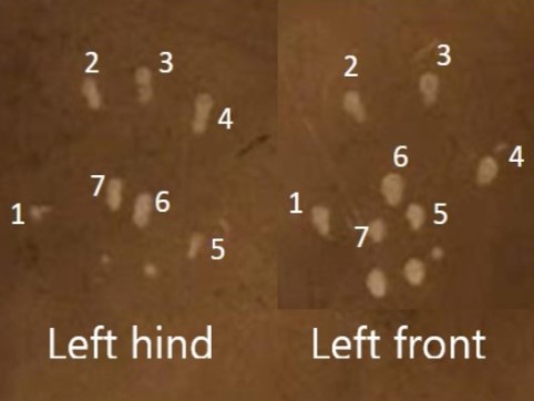
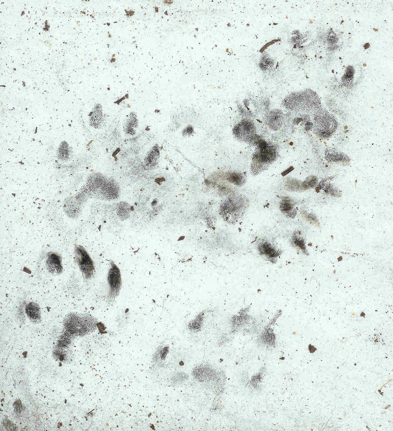
Small mammal left footprints front and hind
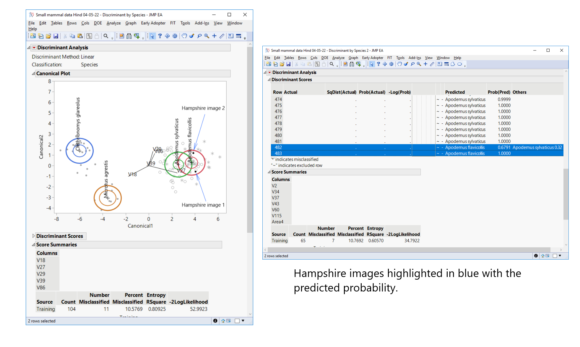
Small mammal footprint analysis
Understanding climate change and other environmental disturbance using an innovative small mammal metric
It’s a major challenge to measure how our natural environment responds to new global threats such as climate change. There are no rapid, cost-effective metrics available.
This international project, with colleagues from South Africa, Greece, Israel, Lebanon, UK and USA, is developing a new metric to inform on environmental disturbance including Climate change. Small mammals are ubiquitous and react rapidly to environmental change, so their populations make an excellent indicator of environmental health and stability.
In this project, small mammal species are being identified from their footprints, collected on cheap and easy-to-deploy track-plates using WildTrack’s award-winning Footprint Identification Technology (FIT) incorporating traditional ecological knowledge, morphometrics and artificial intelligence. Track plates will be fed into an AI pipeline to deliver a species profile list that can inform on environmental health and change - providing a unique, cheap and rapid metric for environmental change.